Troisvierges
 |
, the town of Troisvierges, which lies in the south of the commune, has a population of 1,365. Other towns within the commune include Basbellain, Drinklange, Hautbellain, Huldange, and Wilwerdange.
Until 28 December 1908, the commune was known as "Basbellain", after its former administrative centre. On that date, the administrative centre was moved from Basbellain to Troisvierges.
The coat of arms granted to Troisvierges in 1982 shows three virgins, representing Faith, Hope and Charity; a mountain, for the Oesling region; a stylised papal cross from the oldest known document naming the place; and a railway and wheel, for the importance of the railway in the town's development.
The first known reference to the place was made in 1353 under its German name Ulflingen. The French name Troisvierges was adopted in the 17th century when Walloon pilgrims started using it to refer to the three virgins Saint Fides, Saint Spes and Saint Caritas. The Franciscan church of Troisvierges was built in 1658. By 1900, most of the local population were railway and customs employees. There were some 1,550 inhabitants in 1910.
Troisvierges is known for being the site of the start of hostilities on the Western Front in the First World War. On 1 August 1914, German soldiers of the 69th Infantry Regiment disembarked at the town's railway station, violating the terms of Germany's use of the railways and hence violating Luxembourg's neutrality. This began a four-year occupation of Luxembourg by German forces.
Map - Troisvierges
Map
Country - Luxembourg
 |
 |
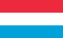
| Flag of Luxembourg | |
With an area of 2,586 km2, Luxembourg is one of the smallest countries in Europe, and the smallest not considered a microstate. In 2022, it had a population of 645,397, which makes it one of the least-populated countries in Europe, albeit with the highest population growth rate; foreigners account for nearly half the population. Luxembourg is a representative democracy headed by a constitutional monarch, Grand Duke Henri, making it the world's only remaining sovereign grand duchy.
Currency / Language
| ISO | Currency | Symbol | Significant figures |
|---|---|---|---|
| EUR | Euro | € | 2 |
| ISO | Language |
|---|---|
| FR | French language |
| DE | German language |
| LB | Luxembourgish language |


